Showing posts with label Castle Rock. Show all posts

Monday, January 31, 2011

30 January--Castle Rock

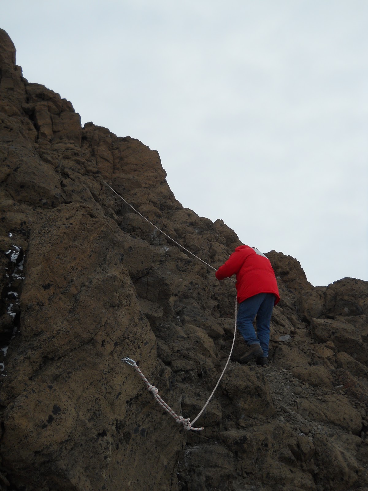
This was the second of my 2 consecutive days off and a welcome break it was.  I finally hiked the Castle Rock Trail and ascended Castle Rock itself.  Jerry Perkins and I left soon after dinner and were back by Mid-Rats.  To hike outside of town any distance, you have to file a plan with the Fire House, have at least 2 people and a radio, have attended the Outdoor Safety lecture, and must check in afterwards.  The trail begins outside of town, up by Arrival Heights, and goes for several miles out to Castle Rock.  Most of it is over hard-packed snow and because of visibility issues, there are flags on bamboo wands every 30 feet or so.  For variety, you can link into a trail that goes back via Scott Base.


 Along the way there are two survival huts called Apples, stocked with sleeping bags and pads; a stove, fuel, and pot; and emergency food.  The second one has a telephone back to base.  I called the Shuttles Office to see if it worked, but was thinking how cool it would be to call Flagstaff.


The Castle is an old volcanic neck made up of basalt and a basalt conglomerate from what must have been a later eruption.  There are lots and lots of basalt pieces included in the reddish brown matrix.  In places there are fixed ropes up the steeper sections of the route.


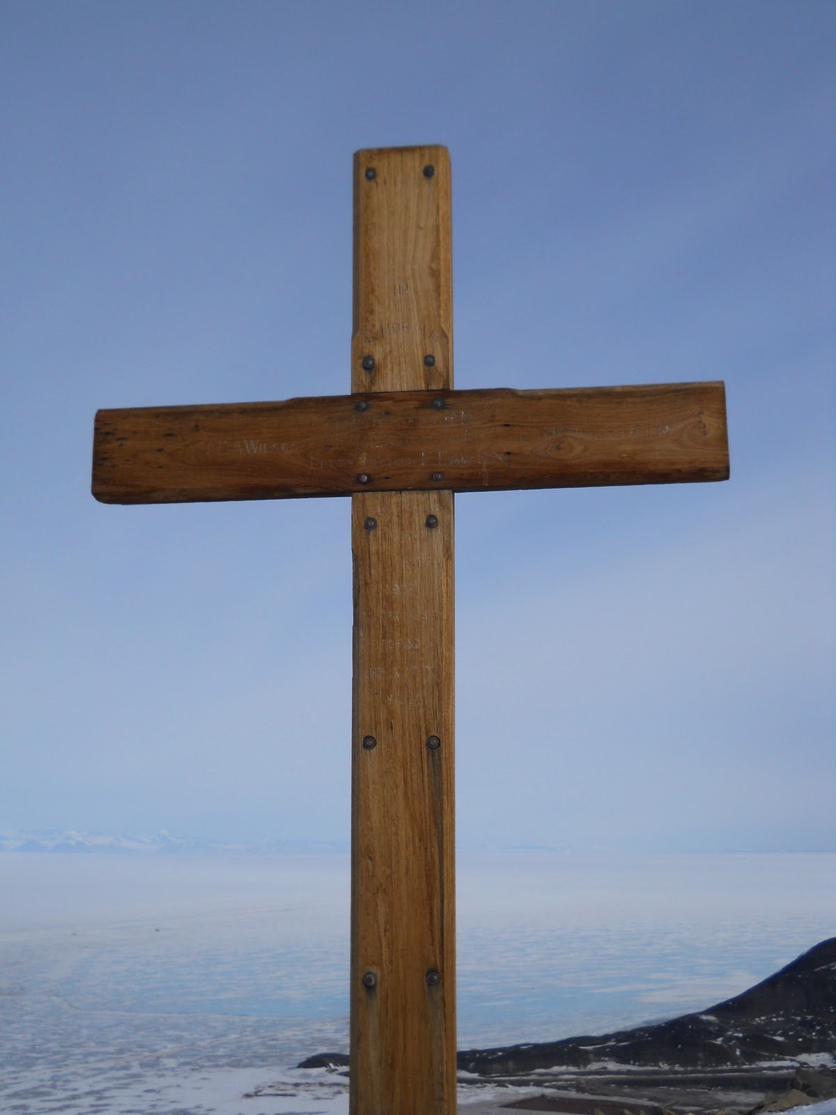
It's been known as Castle Rock since Robert Falcon Scott's first expedition.  Early in that expedition, a party came up into this area and were hit by a blizzard.  The group had done no prior practice or training--that was pretty standard practice for Scott--and were unable to set up their tent.  Some people tried to make their way back to the nearby Discovery Bay and Hut Point.  One man, George Vince, fell off a steep slope, slid into the water, and drowned.  That's the origin of the cross on the low hill above the hut at Hut Point.  Interestingly, another man knew to burrow a bit into a snow bank and let the storm cover him.  He slept out the storm snugly and walked back to Hut Point the next day, none the worse for wear.


Ice crystals growing inside my water bottle.

The open water meets the sea ice.  A few icebergs, calved off from the Erebus Glacier were visible.


Glaciers flowing out of the Royal Society Range across McMurdo Sound


A Skua doing what it does best.

Tri-walls of food waste awaiting retrograde to Port Heuneme for composting.  MREs for Skuas.  Each is about 1 cubic meter.  (Tri-walls are triple thickness cardboard boxes--just the thing for home storage.)

Monday, November 22, 2010

22 November--Pressure Ridges and Rollers


This was my day off but I volunteered for the Recreation Department to drive a van over to the pressure ridges by Scott Base.  Waiting at the Scott Base transition area for a tour group to come back off the ice, I had time and a good vantage point to look out over the ridges.  And that evening a group of us went back for our own tour of the ridges with Scott, Shuttle Jen's husband.


So what's a pressure ridge?  A pressure ridge forms where two masses of ice collide, either by winds or ocean currents.  Sort of like the Himalayas crumpling up along the collision line of the Indo-Australian Plate and the Eurasian Plate.  In this case the masses are the massive Ross Ice Shelf (roughly the size of Texas, if I remember correctly) and the annual sea ice.  The Ross Ice Shelf is the seaward extension of a number of glaciers as the empty into the /Ross Sea; in this area it is moving at least 385 feet a year.  Combine the ice movement and the wind, and you've got the makings for pressure ridges.


When the two ice masses come together, they first express the pressure with gentle corrugations that they call rollers.  With more pressure these steepen and ultimately crack and get raised up spectacularly.  The process from roller to ridge can be as short as two weeks.  In places you can visually follow foot prints going up the pressure ridge, likely made when the ridge was flat ice.  In other places there are seal feces way up a nearly vertical ridge.


The color of the ice can be a topaz blue, nothing you'd expect to see as you sit back in your comfortable home.  Eery.  Luminous.  Hypnotic.


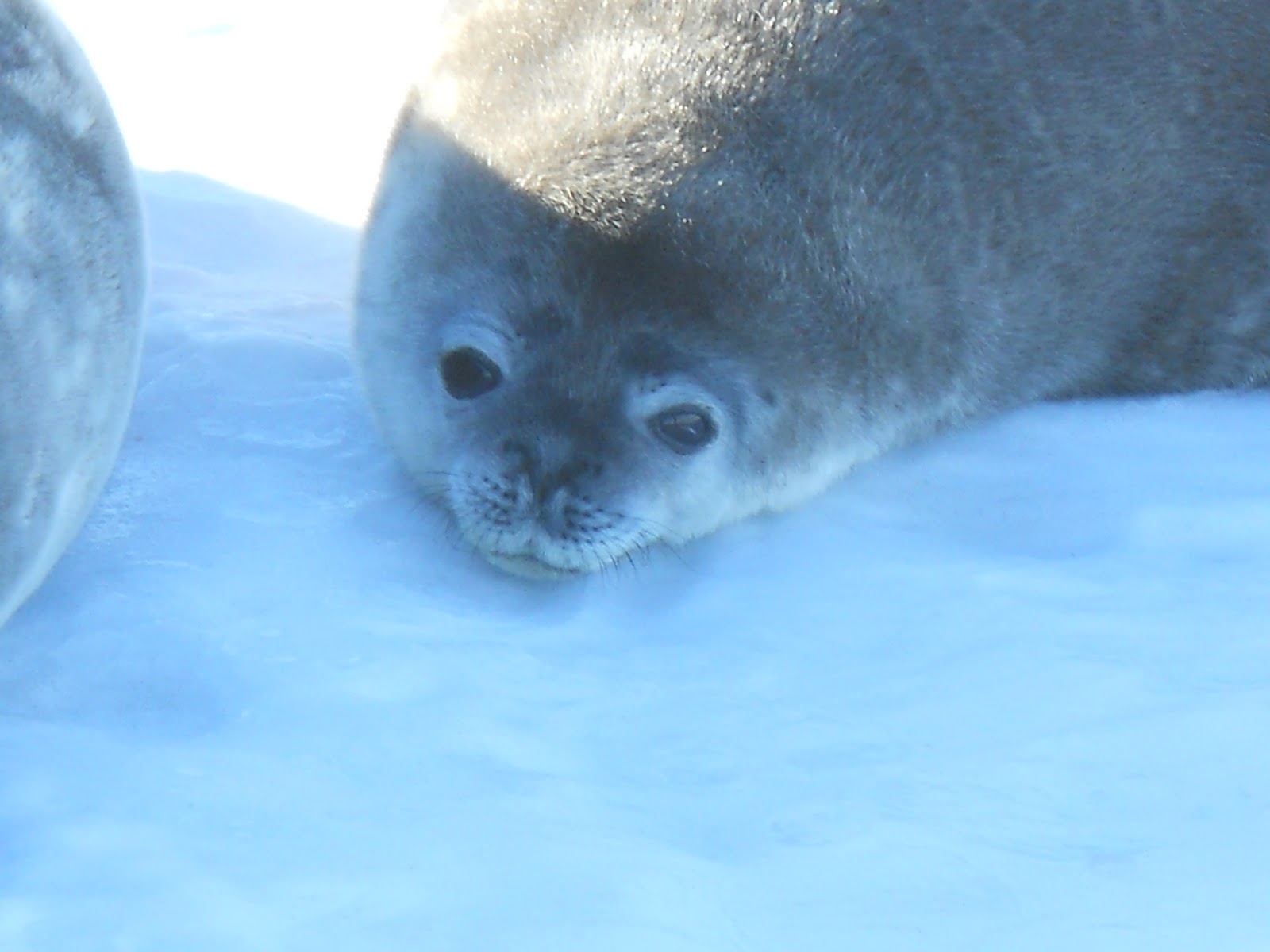
We saw 3 seals out on our walk and were able to get within 15 feet of them..  One was a mother and pup and the other was a solitary individual.  There were patches of melt water with slushy ice that they might have used to go down below, but we didn't see any ice holes.


Interesting tidbit: the elevation of the South Pole is 9,300 feet, but the effective altitude is considerably higher, varying between 10,800 and 13,120 feet, depending on barometric pressure.  This is because as the Earth spins, centrifugal force moves more of the atmosphere to the tropical areas and thins out the atmosphere at the poles.  Polies are usually put on Diamoxx for a few days before flying to the South Pole and I'm told there is a sign inside the Scott-Amundsen Station showing the current equivalent pressure altitude.  Because the North Pole is at sea level, none of this is necessary there.


Monday, November 15, 2010

15 November--An Ob Hill Kind of Morning

Continuing yesterday's roll, I walked up Ob Hill this morning.  Ob Hill is short for Observation Hill, the eminence that Scott's men made daily observations from during the 1904-5 expedition.  It's a bit like Sunset Crater at home, minus the red color, in that it's made up of loose, sliding scree and has a number of trails inscribed in its slopes.  It looks like a number of skiers have been cutting turns down it.  Going up, the first sight you pass is the remains of the nuclear power plant, now just a metal framework that's scheduled to be retrograded back to the states at some point in the future.  Loose fiberglass insulation was blowing around as I passed.


At the top is a cross memorializing Scott and his 4 companions who died after reaching the South Pole one month after Roald Amundsen in 1911, 100 years ago this year.  Amundsen reached the pole, but was kept from enjoying the fame by Scott's "heroic" death and his "sporting" approach that disapproved of such things as skis, warm clothing and sleeping bags of caribou, and dogs (especially eating dogs.  "No thanks, Roald, I prefer to wear cotton clothing in the Antarctic cold and aren't skis a tad ungentlemanly?" 


Amundsen, in his competence, also made it all look so easy.  As an aside, Norway had only gotten its independence from Sweden a decade or so before and Amundsen was just one of a bevy of Norse geniuses (genii?) out to make a mark for their new country.  Another Norwegian finally explained the mechanism of the Northern Lights and invented the way to fix nitrogen from the air making possible synthetic fertilizers and high explosives, although a German got credit for that, too.  Poor Norway, didn't get no respect.

The wind was blasting away on the hike up, threatening to blow me off the ridge at one point.  Some of the basalt rocks are vesicular with "frozen" air pockets; some, especially near the top, have been carved by the  winds blasting, a process that produces what's known as tafoni, I think.  There are even what appear to be swirls that I read as being micro-eddies in the wind.  As an aside, there are storms here known as Herbies, standing for a combination of Hurricanes and Blizzards.  They aren't just a Winter phenomenon and we could still face these this Summer.


From the top there were good views of Mts. Erebus and Terror and of what might be either the line of open water or a darned good Fata Morgana.  What looked like open water was a dark line off on the northern horizon, north of the islands we passed on the way to Cape Evans.  Rumor has it that the dark line is open water; I'm betting on Fata Morgana.


Mount Erebus with Castle Rock in the mid-ground.

Open water on the horizon?  Or a Fata Morgana?

Mounts Erebus and Terror were named after the two ships commanded by Captain Ross (of Ross Sea fame) in the 1840s.  At the time the English tradition was to name its gunboats after either volcanoes or other hellish things.  Erebus comes from Greek mythology and was the son of Chaos.  Erebus was associated with Darkness and Hades, making him a likely candidate for English gunboat naming.

Descending Ob Hill I got nice views of helicopters taking off and landing at the heliport.


I ran across an interesting take on glacial ice being a species of metamorphic rock.  The reasoning goes that it is made up of a mineral (water) and has been compacted, recrystalized, and deformed under pressure--making it metamorphic.

Finally, I' m assembling some webcam sites for Mt. Erebus and the surrounding area.  See what you think.

This is the webcam for the Kiwi's Scott Base:
http://www.antarcticanz.govt.nz/scott-base/webcams

Here's the official site of the Mt. Erebus Volcano Observatory.  No longer an active webcam, but with a good archive of images and videos.
http://erebus.nmt.edu/
I've found dead links to their webcam and references to it being no longer active.  Their archive will have to suffice for now.
McMurdo Station webcam.
http://www.usap.gov/videoclipsandmaps/mcmwebcam.cfm

On the other side of the continent, at Palmer Station on the Antarctic Peninsula (the one that looks like the extension of the Andes--because it is) there is this webcam:
http://www.usap.gov/videoclipsandmaps/palWebCam.cfm

And, of course, there's always that object of crazy desire, the South Pole:
http://www.usap.gov/videoclipsandmaps/spWebCam.cfm

The Brits have their British Antarctic Survey with 4 stations and 2 research vessels.  See it all on their webcams:
http://www.antarctica.ac.uk/images/webcams/index.php

The Australian Antarctic Division likewise has 4 reasearch stations you can view through the links here:
http://www.antarctica.gov.au/webcams

Here's a webcam that features a Gentoo penguin rookery, updated every 15 minutes.
http://www.martingrund.de/pinguine/

The Germans have their Neumayer-Station on the Weddell Sea:
http://www.awi-bremerhaven.de/NM_WebCam/

There must be others, too. and I'll keep looking from time to time.