I'll lay out here a series of maps, starting with the most all encompassing and zooming in smaller and smaller.
Here's a pretty good overall map of the continent. You can see the Ross Sea and Ross Ice Shelf. Interesting point: if you were to stand on the exact geographic South Pole, north would be in ALL directions around you. This makes it a bit tough to give you directions to the Ross Sea on this map. The Ross Sea is EAST (or Counter-Clockwise) of the Amundsen Sea. Or near the bottom of the map.

On the other hand, here's a hilarious one that shows how you can distort things with the proper--or not so proper--map projection.

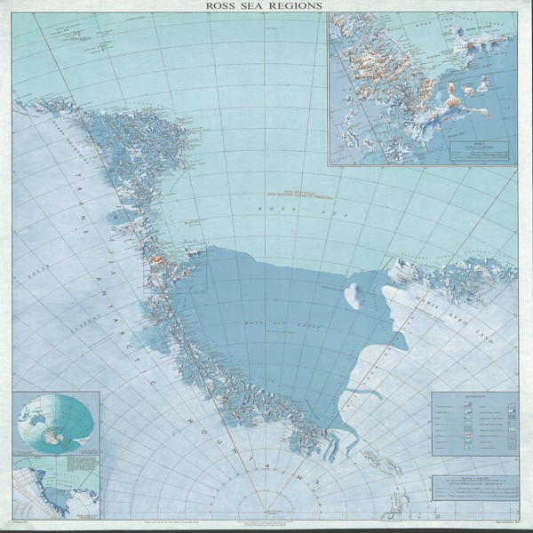
Zooming in a bit, this is a closer view of the Ross Sea area. McMurdo Sound is on the western edge of the Ross Sea (the left hand side). You can see how close McMurdo is to the edge of the Ross Ice Shelf. It's also close to the edge of the sea ice that thins and melts each year.
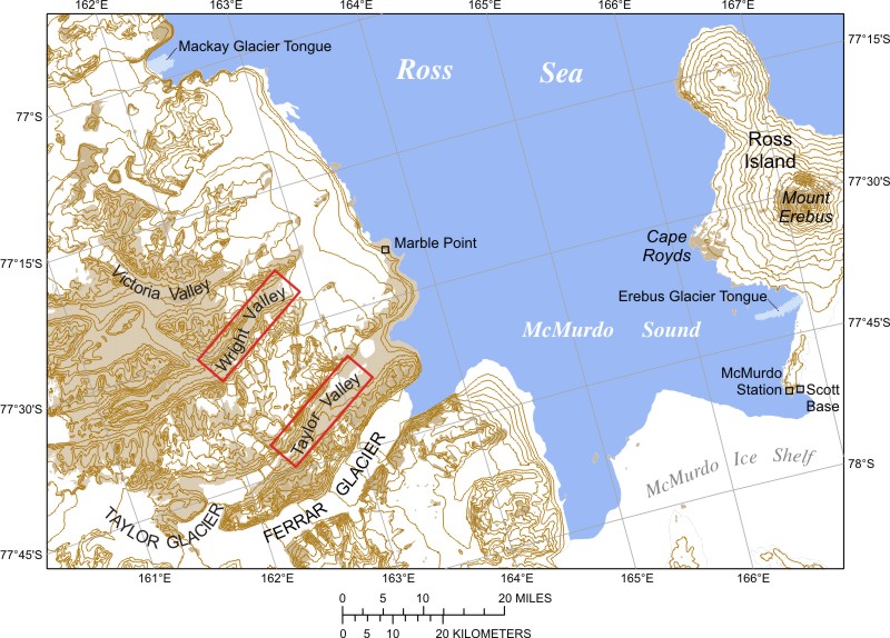
Zooming in further you can see McMurdo Sound, an embayment of the Ross Sea. McMurdo Station is on Ross Island, dominated by Mt. Erebus
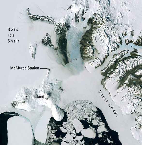
Another view of a smaller portion of McMurdo Sound
In this place I'll soon be placing a still smaller map of the McMurdo Station neighborhood so that you can see the station and the outlying places such as Happy Camper, the Ice Runway, and Pegasus Field. I've been promised that this is coming. The Ross Ice Shelf, not quite the size of Texas, is said to move north about four miles a year, pushed by glaciers from the interior of the continent, necessitating movement of some of the facilities each year and, hence, remapping the area.
This has some interesting links to various things about Antarctica:
http://www.livescience.com/antarctica/
This, too. The good old National Geographic.
http://ngm.nationalgeographic.com/ngm/antarctica/
Here's a pretty good overall map of the continent. You can see the Ross Sea and Ross Ice Shelf. Interesting point: if you were to stand on the exact geographic South Pole, north would be in ALL directions around you. This makes it a bit tough to give you directions to the Ross Sea on this map. The Ross Sea is EAST (or Counter-Clockwise) of the Amundsen Sea. Or near the bottom of the map.
On the other hand, here's a hilarious one that shows how you can distort things with the proper--or not so proper--map projection.
Zooming in a bit, this is a closer view of the Ross Sea area. McMurdo Sound is on the western edge of the Ross Sea (the left hand side). You can see how close McMurdo is to the edge of the Ross Ice Shelf. It's also close to the edge of the sea ice that thins and melts each year.
Zooming in further you can see McMurdo Sound, an embayment of the Ross Sea. McMurdo Station is on Ross Island, dominated by Mt. Erebus
Another view of a smaller portion of McMurdo Sound
In this place I'll soon be placing a still smaller map of the McMurdo Station neighborhood so that you can see the station and the outlying places such as Happy Camper, the Ice Runway, and Pegasus Field. I've been promised that this is coming. The Ross Ice Shelf, not quite the size of Texas, is said to move north about four miles a year, pushed by glaciers from the interior of the continent, necessitating movement of some of the facilities each year and, hence, remapping the area.
This has some interesting links to various things about Antarctica:
http://www.livescience.com/antarctica/
This, too. The good old National Geographic.
http://ngm.nationalgeographic.com/ngm/antarctica/
No comments:
Post a Comment