Tuesday, November 23, 2010

23 November--Ob Hill Loop


A luxurious day off and I was able to sleep in until 0630, something I haven't done in ages!  Hit the gym and after lunch go on a hike I hadn't known about around the base of Ob Hill.  It starts down below the Heliport and goes around the hill until it hits the road to Scott Base in Gas Pass.  Once you get around the hill a bit, the sounds and sights of town fall away.  Most of the trail is fairly flat and passes across volcanic cinder slopes with a few volcanic bombs.  In a few places it gets steep and snow covered, but the trail volunteers have done a wonderful job clearing away the worst.  There are great views across the sound to the Royal Society Range and. later on, to Scott Base and the Ross Ice Shelf.  I hadn't seen the boundary between the ice shelf and the annual sea ice before, but it's pretty distinct.  The contrast between the hike here and yesterday's walk around the pressure ridges couldn't be greater.


Passing by the Heliport.


That long and winding road...

Weddell seals sunning themselves in the warm sun.

Mt. Terror, Scott Base, and the Ross Ice Shelf.

Hiking Ob Hill reminds me a lot of hikes in the Flagstaff area.


Volcanic bomb.  Note the spiraling, ropey structure from end to end.


Cheaper by the dozen.
 Addendum: after posting all of the  above, I went on a short hike at 2100 hours to the Observation Tube.  The krill are getting bigger and I saw 2 ethereal, white jelly fish.  There was a weird call of a seal from a distance, nothing like the sounds you might associate with a Sea World performance.  It was almost like those recordings of whales you might remember from the 1970s.


When we came up from the tube and were going back across the ice to shore, we spotted broken ice on the surface of the partially refrozen surface of a melt water pool.  Waiting quietly we were able to see a Weddell seal come to the surface and blow off CO2 noisily.  He came back at about 5 or 6 minute intervals.


Learned that this is the first year that the Observation Tube has been here.  Previously it was at a penguin research site elsewhere in the Ross Sea.

Monday, November 22, 2010

22 November--Pressure Ridges and Rollers


This was my day off but I volunteered for the Recreation Department to drive a van over to the pressure ridges by Scott Base.  Waiting at the Scott Base transition area for a tour group to come back off the ice, I had time and a good vantage point to look out over the ridges.  And that evening a group of us went back for our own tour of the ridges with Scott, Shuttle Jen's husband.


So what's a pressure ridge?  A pressure ridge forms where two masses of ice collide, either by winds or ocean currents.  Sort of like the Himalayas crumpling up along the collision line of the Indo-Australian Plate and the Eurasian Plate.  In this case the masses are the massive Ross Ice Shelf (roughly the size of Texas, if I remember correctly) and the annual sea ice.  The Ross Ice Shelf is the seaward extension of a number of glaciers as the empty into the /Ross Sea; in this area it is moving at least 385 feet a year.  Combine the ice movement and the wind, and you've got the makings for pressure ridges.


When the two ice masses come together, they first express the pressure with gentle corrugations that they call rollers.  With more pressure these steepen and ultimately crack and get raised up spectacularly.  The process from roller to ridge can be as short as two weeks.  In places you can visually follow foot prints going up the pressure ridge, likely made when the ridge was flat ice.  In other places there are seal feces way up a nearly vertical ridge.


The color of the ice can be a topaz blue, nothing you'd expect to see as you sit back in your comfortable home.  Eery.  Luminous.  Hypnotic.


We saw 3 seals out on our walk and were able to get within 15 feet of them..  One was a mother and pup and the other was a solitary individual.  There were patches of melt water with slushy ice that they might have used to go down below, but we didn't see any ice holes.


Interesting tidbit: the elevation of the South Pole is 9,300 feet, but the effective altitude is considerably higher, varying between 10,800 and 13,120 feet, depending on barometric pressure.  This is because as the Earth spins, centrifugal force moves more of the atmosphere to the tropical areas and thins out the atmosphere at the poles.  Polies are usually put on Diamoxx for a few days before flying to the South Pole and I'm told there is a sign inside the Scott-Amundsen Station showing the current equivalent pressure altitude.  Because the North Pole is at sea level, none of this is necessary there.


Saturday, November 20, 2010

20 November--Baslers on the Mind


I've been wondering about Baslers since we got here.  Why Basler?  They're really just DCs or C-47s, right?  Well, sort of.  I got a lot more of the story this morning from a young Canadian who just got in the other day and who works for Kenn Borek Aviation of Calgary.  It turns out that they are indeed C-47s or DC-3s, but with a big difference.  [Later correction: they are only C-47s.  The DC-3s are just slightly enough different that they won't work for this purpose.]

The C-47s and Dc-3s were built during World War II and, according to this guy, they were built knowing that they were likely to be shot down in pretty short order and so why build them too good?  The engines were designed to only last for 1,000 hours.  But it turned out that not only were they supremely airworthy, they had the strongest airframe ever (?) built.  They were what allowed the US to fly supplies over the Hump from India to China to supply the Nationalists against the Japanese and the Communists. And probably a thousand other things, in addition.

When the war ended, there were lots of these that were still flying and they were disposed of all over Asia and many made it to Central and South America, Alaska, and Canada.  I flew in one in the Amazon, as I think I wrote earlier, and thought then that they were pretty old back in 1970.  But that was then and this is now.

Somewhere along the line someone had the great idea to take the basic plane, gut it, and rebuild virtually everything on it.That's where Basler of Oshkosh (B'Gosh!) Wisconsin comes in.  They take a sound airframe and add 6 feet in length to it; replace the landing gear with beefed up replacements; replace the old rotary engines with turbo props for more power; and completely update all the hydraulic, electrical, and avionics.  What comes in an old derelict, comes out as a  virtually new $6,000,000 workhorse.  And that seems cheap to me!

Kenn Borek Aviation scouts these out in out-of-the-way places and gets them to Oshkosh for Basler to convert.  A crew member earlier told me that one of their planes came from the Guatemalan Air Force.  The Guatemalans had 5 or 6 of them and none could be flown.  KBA came in with their infinitely resourceful crews--working in the best bush pilot tradition-- and got them all working.  In return KBA got to keep one of them and take it to Oshkosh.  KBA is supposed to have 55-60 of them.

As an aside, KBA works in Alaska, Greenland, and the Canadian Arctic during the boreal summer flying mining crews around and delivering groceries to First Nations villages.  (Another KBA employee said that most of the groceries they flew in were chips, cookies, soda pop, and white flour.  Sadly, it sounded so much like the situation on the reservations at home.  Nutritional deserts.)  When it comes time to shift to Antarctica for the austral summer, they take a few days and hop down to the US; the Cayman Islands; Guayaquil, Ecuador; Ushuaia, Chile; and Rothera Station of the British Antarctic Survey in western Antarctica.  From there they fan out to various stations on the continent.  The seven that will come to McMurdo will hop to the South Pole one day and then to McMurdo the next.  In February the process runs in reverse.

I asked where their pilots come from and didn't get a real answer.  But I also asked whether they had retired Air Force pilots working on their staff and he said absolutely not, that they don't have nearly enough flight hours to work for them.  Their pilots usually have in excess of 20,000 hours.  My impression is that Air Force pilots might only have 1,500 hours.  I'll check on that at some point.


Scary thought:   I recently heard that the Fuelies get a regular blood test to detect levels of petroleum in their system.  Those folks are so fragrant of jet fuel or diesel that sometimes when I pick them up in a shuttle vehicle, I have to open the windows and crank up the heat to clear out the van.  They have to hang their work clothes outside their dorm rooms to air them out and avoid driving out their roommates.  And to think that I interviewed with Fuels before I got the Vehicle Operator position!

A Skua in its unnatural habitat.

Thursday, November 18, 2010

18 November--Meet the Doc(s)


Meet Doctor Harry Owens, head doctor of the McMurdo General Hospital.  My biggest disappointment is that you'll never be able to meet Harry.  He's absolutely inspirational!  Harry has been coming down here for 4 of the last 5 seasons, if I have this right.  But as I talk to him in the clinic (for my back) or at a table in the galley, more and more things just keep spilling out.  For instance, he once had a practice in Alaska for a while, but much of his career has been in very remote and under-served areas, like little Inuit bush villages in northern Alaska or on the Aleutian Peninsula.  Some of these have been in public health clinic settings and many others as a volunteer, most likely with expenses covered.  He's also spent a good long time as a doctor on a boat on the Amazon River in Brazil and most recently in southern Sudan.  Working on the Amazon, he learned Portuguese and used that later working in Guinea-Bissau and Mozambique, other parts of the Portuguese speaking world.  I can't even remember the list of all the countries he's volunteered in as doctor, but believe me, it's long.  A number of people do this sort of thing in their retirement after they have worked through their careers; Harry has been doing this for much of his career. 

As an aside, I learned later--after this was originally posted--that he grew up on a sheep ranch 25 miles northeast of Flagstaff and still has relatives living in town.

One of his secrets has been to keep his wants and needs low, though he apparently he has a small forest cabin in the Willamette Valley in Oregon to retreat to between medical tours. You have probably never met anyone as cheerful, upbeat, and eternally optimistic as Dr. Harry.  He's the sort of person I can vaguely remember reading about at my aunt's house in the "My Most Unforgettable Character" section in her Reader's Digest magazine.  Much better would be a New Yorker profile of him by one of my favorite non-fiction writers, John McPhee.  Does anyone out there know of a budding writer who could write about this marvel for the larger world?  I'm serious!  Let me know and I can get his contact information.

Some of you have asked about how we live.  There are a number of dorms here, but most FNGs start off at Building 155.  It's conveniently central to everything, including the galley, computer kiosk, barber shop, the store, ATM (yes, an ATM, who would have figured that?) and recreation office.  Some of the rooms along the outside walls have windows, which is problematical during the 4 months of 24 hour a day light.  Keeping the room dark enough to sleep can be a challenge.  During the winter I suspect these rooms could be colder.  Many more of the rooms have no window, which can be a bit creepy at first.  Mine is one of those. 

My corner of the room.
   We each get a wardrobe, a nightstand and part of a bunk-bed.  We've chosen to set them up as singles and I've got my raised high enough that the nightstand fits partly under the bed to save room and giving me more storage under the bed.  Two of the roommates have hung blankets around their corners, giving themselves more privacy, but making their corner even more dungeon-like to my tastes.


I think this is the famous milvan (shipping container) that was blown over by the wind at some point recently.  Look closely and you'll see 3 concrete blocks attached to it; there are several more on the other side.  It took the milvan and the blocks and rolled them all over a few times.  If I'm right, a cubic yard of concrete is about a ton.


This is located up on a hill called T-Site and I get to drive up here a few times a week.  The view is stunning.  There's an exciting NASA project going on up there that will have very real and spectacular results for all of us over the next few years.  Currently, all the worldwide satellite data that the the Big Guys use is at least 2 hours old when they get it to number crunch and it only covers about two thirds of the land areas of the globe.  This project will raise the percentage to 100% of the land and drop the time lag to 23 minutes.  This should have big implications for tornado forecasts in the Midwest and flooding predictions in low-lying places like Bangladesh.  (Maybe even New Orleans?  Nah, that gets into issues of race andclass.)  It relies on some new satellites going up and these haven't been budgeted yet so far, but let's hope that that happens.

Finally, I haven't been able to keep myself away from the Ob Tube and its ethereal lighting.  Here are a few more of that.


As wonderful as seeing all this for the 4th (!) time was, it was perhaps even neater seeing it through the eyes of someone else, someone new to it.  The trip was spontaneous.  Another shuttle driver came over at dinner and I was describing how fantastic the views were under the ice.  We decided to go back and see it again.  A gentleman sitting near us asked if he could go along and we invited him, too.  It turned out that he was a grantee down here for 3 weeks from the University of Alabama at Birmingham.  Dr. Asim Bej, here 30 years from his native Kolkata, has as his specialty the DNA of the algae and bacteria that grow under the ice.  Divers bring him the samples from under the ice or get samples from under the frozen lakes of the Dry Valleys, but he had actually never seen these in the wild.  He went ecstatic over seeing his field of study in its actual setting, in its context.  It was such a pleasure to have helped him get to see this.  Very gratifying!

To close, in an adjoining room someone is practicing "Over the Rainbow" and "Greensleeves" on the tuba of all instruments--over and over again and not all that well.  A real experience.  Bless them, they deserve to get good.

Monday, November 15, 2010

15 November--An Ob Hill Kind of Morning

Continuing yesterday's roll, I walked up Ob Hill this morning.  Ob Hill is short for Observation Hill, the eminence that Scott's men made daily observations from during the 1904-5 expedition.  It's a bit like Sunset Crater at home, minus the red color, in that it's made up of loose, sliding scree and has a number of trails inscribed in its slopes.  It looks like a number of skiers have been cutting turns down it.  Going up, the first sight you pass is the remains of the nuclear power plant, now just a metal framework that's scheduled to be retrograded back to the states at some point in the future.  Loose fiberglass insulation was blowing around as I passed.


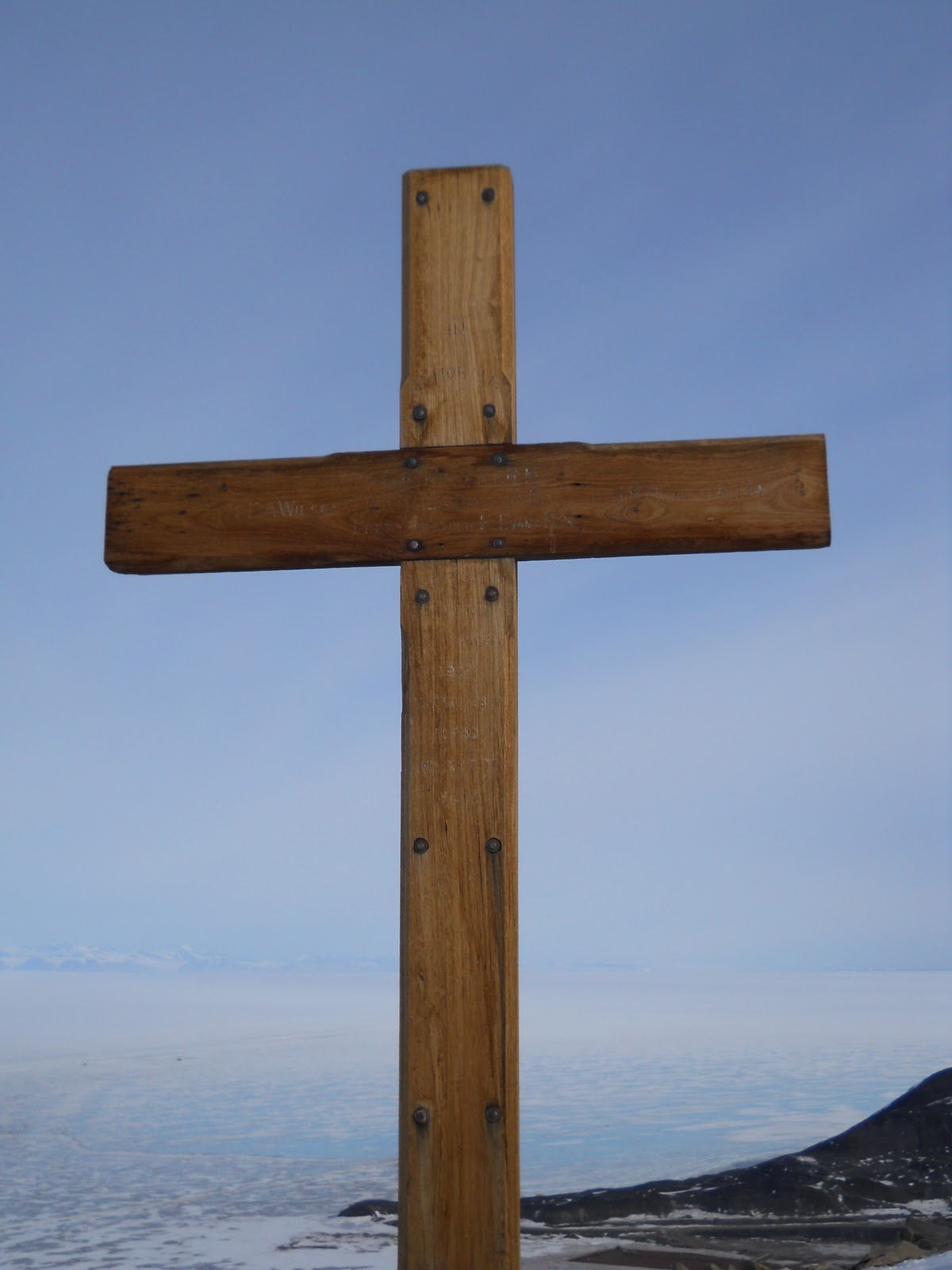
At the top is a cross memorializing Scott and his 4 companions who died after reaching the South Pole one month after Roald Amundsen in 1911, 100 years ago this year.  Amundsen reached the pole, but was kept from enjoying the fame by Scott's "heroic" death and his "sporting" approach that disapproved of such things as skis, warm clothing and sleeping bags of caribou, and dogs (especially eating dogs.  "No thanks, Roald, I prefer to wear cotton clothing in the Antarctic cold and aren't skis a tad ungentlemanly?" 


Amundsen, in his competence, also made it all look so easy.  As an aside, Norway had only gotten its independence from Sweden a decade or so before and Amundsen was just one of a bevy of Norse geniuses (genii?) out to make a mark for their new country.  Another Norwegian finally explained the mechanism of the Northern Lights and invented the way to fix nitrogen from the air making possible synthetic fertilizers and high explosives, although a German got credit for that, too.  Poor Norway, didn't get no respect.

The wind was blasting away on the hike up, threatening to blow me off the ridge at one point.  Some of the basalt rocks are vesicular with "frozen" air pockets; some, especially near the top, have been carved by the  winds blasting, a process that produces what's known as tafoni, I think.  There are even what appear to be swirls that I read as being micro-eddies in the wind.  As an aside, there are storms here known as Herbies, standing for a combination of Hurricanes and Blizzards.  They aren't just a Winter phenomenon and we could still face these this Summer.


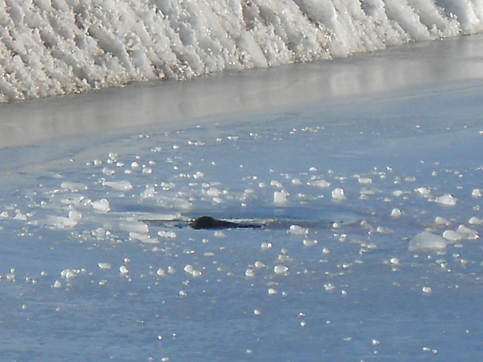
From the top there were good views of Mts. Erebus and Terror and of what might be either the line of open water or a darned good Fata Morgana.  What looked like open water was a dark line off on the northern horizon, north of the islands we passed on the way to Cape Evans.  Rumor has it that the dark line is open water; I'm betting on Fata Morgana.


Mount Erebus with Castle Rock in the mid-ground.

Open water on the horizon?  Or a Fata Morgana?

Mounts Erebus and Terror were named after the two ships commanded by Captain Ross (of Ross Sea fame) in the 1840s.  At the time the English tradition was to name its gunboats after either volcanoes or other hellish things.  Erebus comes from Greek mythology and was the son of Chaos.  Erebus was associated with Darkness and Hades, making him a likely candidate for English gunboat naming.

Descending Ob Hill I got nice views of helicopters taking off and landing at the heliport.


I ran across an interesting take on glacial ice being a species of metamorphic rock.  The reasoning goes that it is made up of a mineral (water) and has been compacted, recrystalized, and deformed under pressure--making it metamorphic.

Finally, I' m assembling some webcam sites for Mt. Erebus and the surrounding area.  See what you think.

This is the webcam for the Kiwi's Scott Base:
http://www.antarcticanz.govt.nz/scott-base/webcams

Here's the official site of the Mt. Erebus Volcano Observatory.  No longer an active webcam, but with a good archive of images and videos.
http://erebus.nmt.edu/
I've found dead links to their webcam and references to it being no longer active.  Their archive will have to suffice for now.

McMurdo Station webcam.
http://www.usap.gov/videoclipsandmaps/mcmwebcam.cfm

On the other side of the continent, at Palmer Station on the Antarctic Peninsula (the one that looks like the extension of the Andes--because it is) there is this webcam:
http://www.usap.gov/videoclipsandmaps/palWebCam.cfm

And, of course, there's always that object of crazy desire, the South Pole:
http://www.usap.gov/videoclipsandmaps/spWebCam.cfm

The Brits have their British Antarctic Survey with 4 stations and 2 research vessels.  See it all on their webcams:
http://www.antarctica.ac.uk/images/webcams/index.php

The Australian Antarctic Division likewise has 4 reasearch stations you can view through the links here:
http://www.antarctica.gov.au/webcams

Here's a webcam that features a Gentoo penguin rookery, updated every 15 minutes.
http://www.martingrund.de/pinguine/

The Germans have their Neumayer-Station on the Weddell Sea:
http://www.awi-bremerhaven.de/NM_WebCam/

There must be others, too. and I'll keep looking from time to time.